Toggle navigation
Survey Documents
Advanced Search
Supporting Data
Companies
Surveyors
Communities
Original Townships
APIs
Survey Documents API
Tutorial
About
Contact
Search
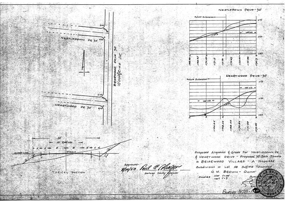
3178-1
Download SURVEY-3178-1_0001.tif
GIS Data
Latitude:
41.0225199999999
Longitude:
-81.38657
Identification
Survey identifier:
3178-1
Context
Original township:
Suffield
Community list:
Surveyed on:
08/10/1953
Description
Owner:
O.M.Brown
Description:
Primary road:
Nestledown Drive
Secondary road:
Heartwood Drive
Near intersection:
Woodbriar Drive
Acreage:
Survey Locators
Tract list:
Lot list:
48
Section list:
Quarter:
Surveyor
Surveyor number:
4240
Surveyor name:
Fish, Robert J.
Company:
Document Data
Scan File Name:
SURVEY-3178-1_0001.tif
Scan Pages:
1
Drawer location:
016