Toggle navigation
Survey Documents
Advanced Search
Supporting Data
Companies
Surveyors
Communities
Original Townships
APIs
Survey Documents API
Tutorial
About
Contact
Search
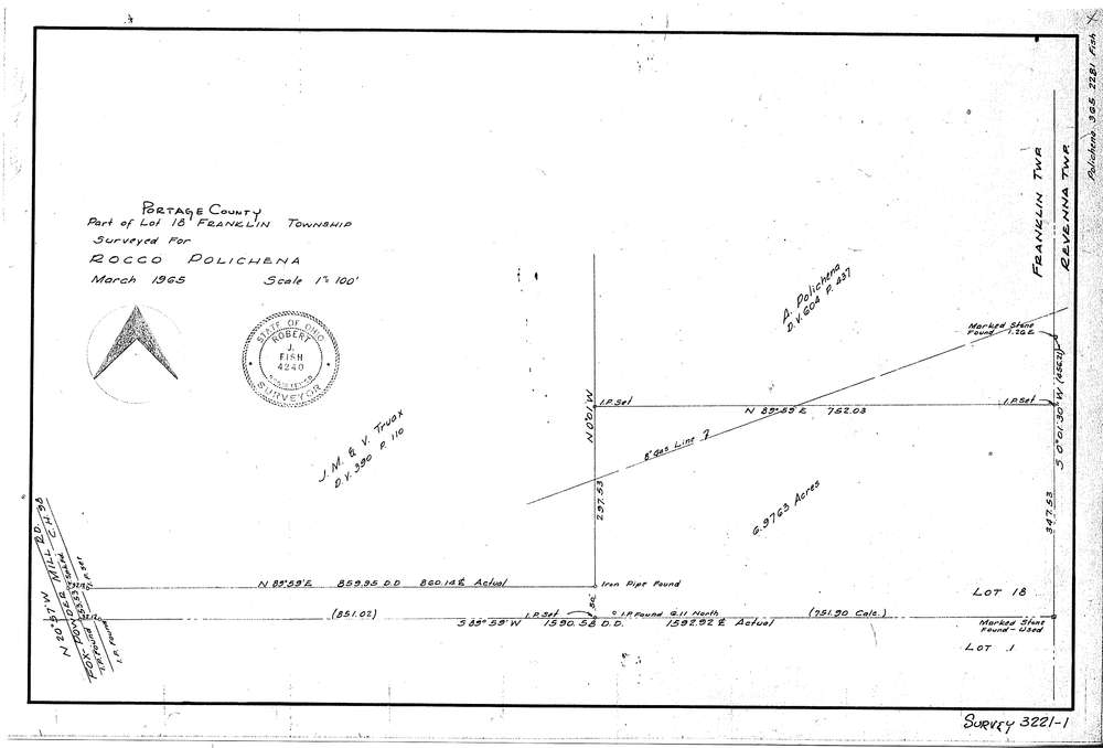
3221-1
Download SURVEY-3221-1_0001.tif
GIS Data
Latitude:
41.1395069999999
Longitude:
-81.300182
Identification
Survey identifier:
3221-1
Context
Original township:
Franklin
Community list:
Surveyed on:
03/01/1965
Description
Owner:
Rocco Polichena
Description:
Primary road:
Fox Powder Road C.H.98
Secondary road:
Near intersection:
Acreage:
6.9763
Survey Locators
Tract list:
Lot list:
18
Section list:
Quarter:
Surveyor
Surveyor number:
4240
Surveyor name:
Fish, Robert J.
Company:
Document Data
Scan File Name:
SURVEY-3221-1_0001.tif
Scan Pages:
1
Drawer location:
016