Toggle navigation
Survey Documents
Advanced Search
Supporting Data
Companies
Surveyors
Communities
Original Townships
APIs
Survey Documents API
Tutorial
About
Contact
Search
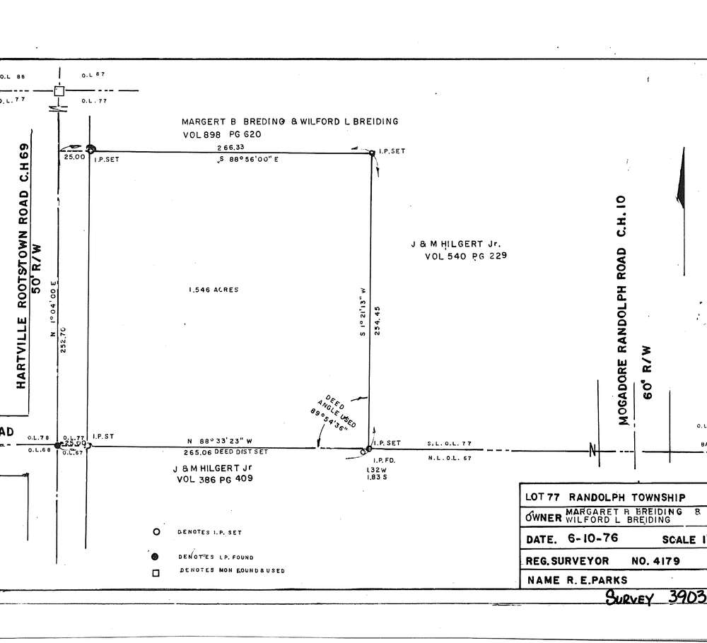
3903-2
Download SURVEY-3903-2_0001.tif
GIS Data
Latitude:
41.0411299999999
Longitude:
-81.26845
Identification
Survey identifier:
3903-2
Context
Original township:
Randolph
Community list:
Surveyed on:
06/10/1976
Description
Owner:
Margret and Wilford Breiding
Description:
Primary road:
Hartville Road C.H.69
Secondary road:
Near intersection:
Luli Road T.R.40
Acreage:
1.546
Survey Locators
Tract list:
Lot list:
77
Section list:
Quarter:
Surveyor
Surveyor number:
4179
Surveyor name:
Parks, R.E.
Company:
Document Data
Scan File Name:
SURVEY-3903-2_0001.tif
Scan Pages:
1
Drawer location:
016