Toggle navigation
Survey Documents
Advanced Search
Supporting Data
Companies
Surveyors
Communities
Original Townships
APIs
Survey Documents API
Tutorial
About
Contact
Search
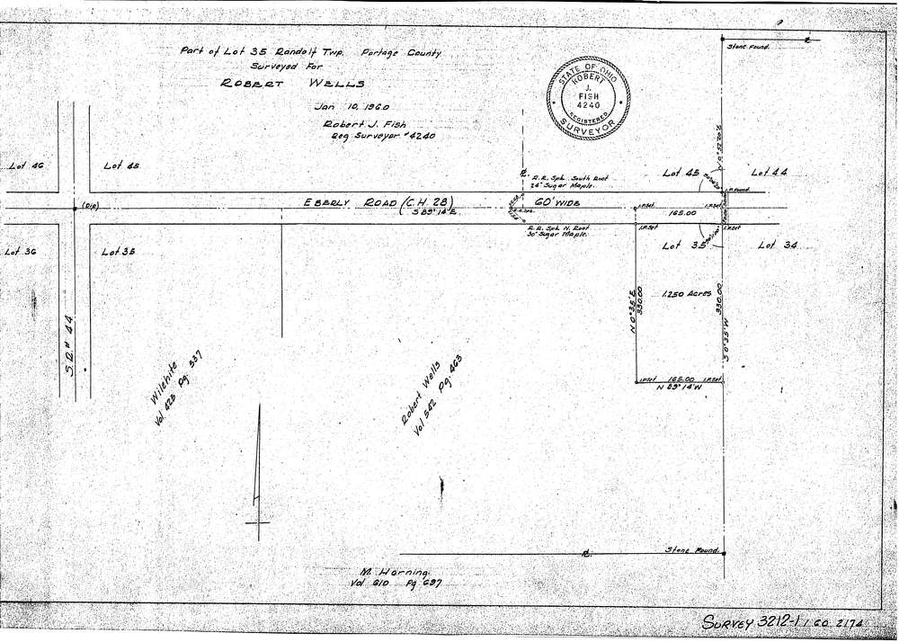
3212-1
Download SURVEY-3212-1_0001.tif
GIS Data
Latitude:
41.0177499999999
Longitude:
-81.23792
Identification
Survey identifier:
3212-1
Context
Original township:
Randolf
Community list:
Surveyed on:
01/10/1960
Description
Owner:
Robert Wells
Description:
Primary road:
Eberly Road CH 28
Secondary road:
Near intersection:
Ravenna Louisville Road SR 44
Acreage:
1.25
Survey Locators
Tract list:
Lot list:
35
Section list:
Quarter:
Surveyor
Surveyor number:
4240
Surveyor name:
Fish, Robert J.
Company:
Document Data
Scan File Name:
SURVEY-3212-1_0001.tif
Scan Pages:
1
Drawer location:
016