Toggle navigation
Survey Documents
Advanced Search
Supporting Data
Companies
Surveyors
Communities
Original Townships
APIs
Survey Documents API
Tutorial
About
Contact
Search
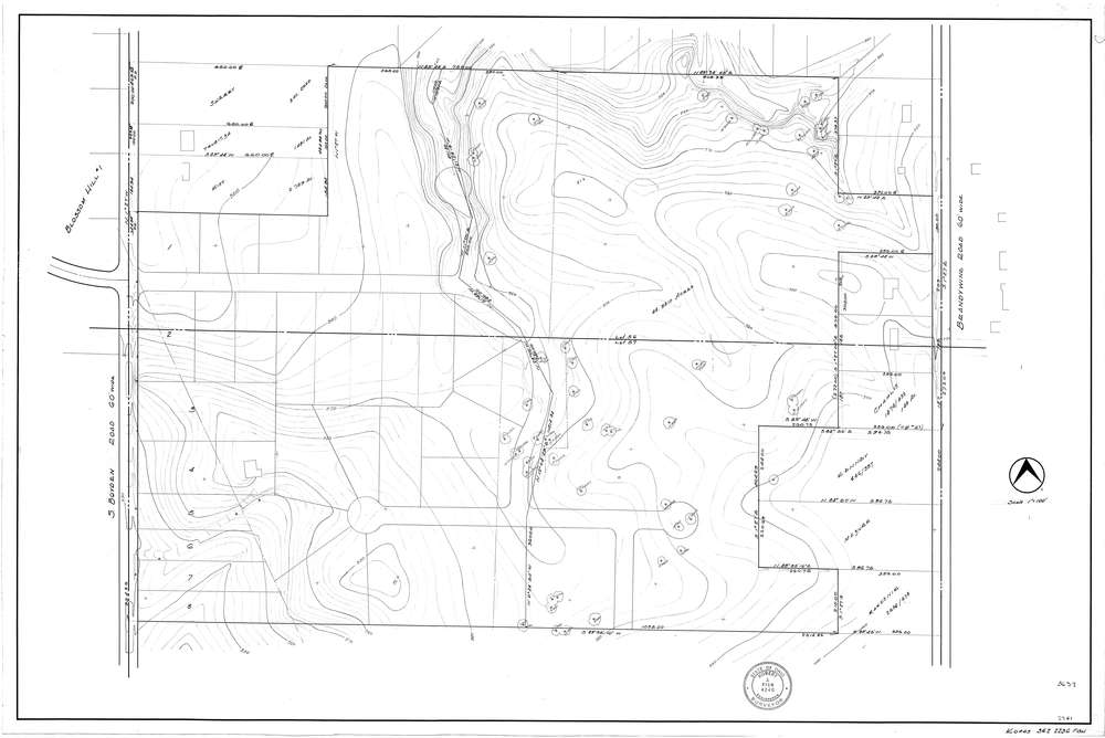
3637
Download f2236b.tif
GIS Data
Latitude:
41.3069229999998
Longitude:
-81.544132
Identification
Survey identifier:
3637
Context
Original township:
Northfield
Community list:
Sagamore Hills
Surveyed on:
Description
Owner:
Description:
Topo - No date
Primary road:
Brandywine Rd
Secondary road:
Near intersection:
Acreage:
Survey Locators
Tract list:
Lot list:
56, 57
Section list:
Quarter:
Surveyor
Surveyor number:
4240
Surveyor name:
Fish, Robert J.
Company:
Document Data
Scan File Name:
f2236b.tif
Scan Pages:
1
Drawer location: