Toggle navigation
Survey Documents
Advanced Search
Supporting Data
Companies
Surveyors
Communities
Original Townships
APIs
Survey Documents API
Tutorial
About
Contact
Search
3669
Download lotsplits3669.tif
GIS Data
Latitude:
41.0630129999998
Longitude:
-81.427488
Identification
Survey identifier:
3669
Context
Original township:
Akron
Community list:
Akron
Surveyed on:
Description
Owner:
Description:
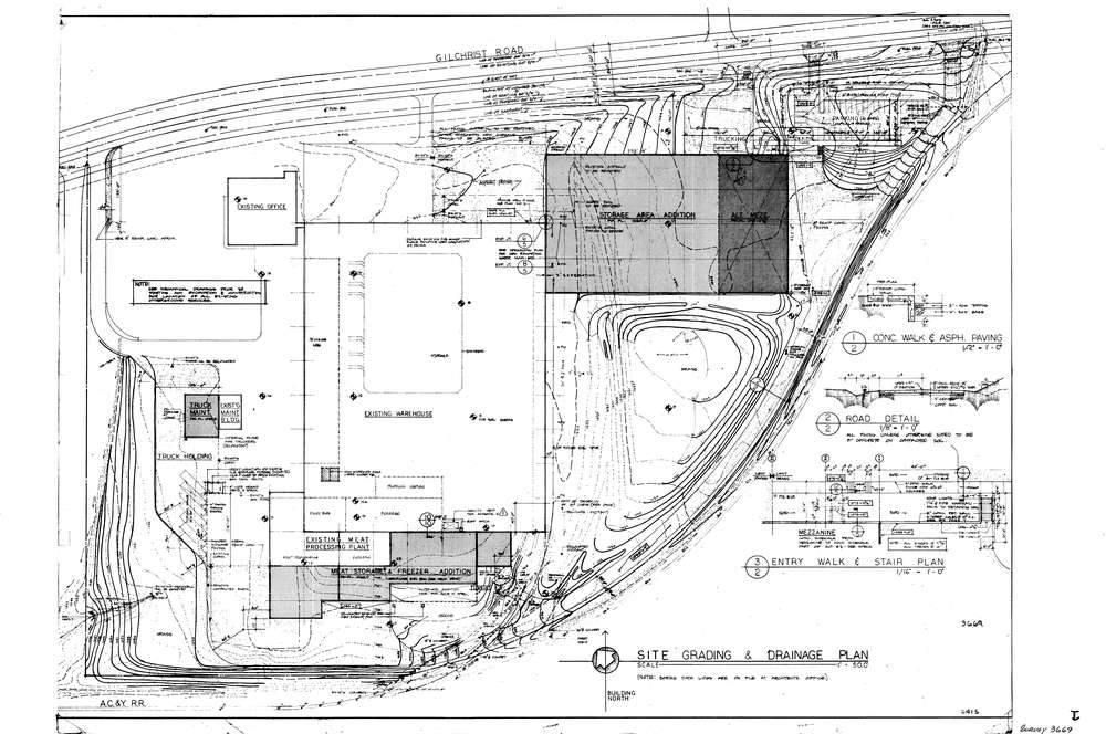
Site Grading & Drainage Plan
Primary road:
Gilchrist Rd
Secondary road:
Near intersection:
Skelton Rd
Acreage:
Survey Locators
Tract list:
Lot list:
Section list:
Quarter:
Surveyor
Surveyor number:
Surveyor name:
Company:
Document Data
Scan File Name:
lotsplits3669.tif
Scan Pages:
1
Drawer location: